
13. ỨNG DỤNG CÔNG NGHỆ WEBGIS ĐỂ QUẢN LÝ THÔNG TIN GIÁ ĐẤT TẠI THỊ TRẤN PHÙNG, HUYỆN ĐAN PHƯỢNG, THÀNH PHỐ HÀ NỘI
Thanh bên bài viết
-
Đất đai Land
Giới thiệu
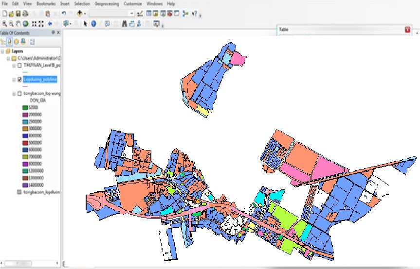
Hiện nay chúng ta đang trong bối cảnh cách mạng công nghiệp lần thứ 4 với nền tảng là ứng dụng công nghệ thông tin vào trong tất cả các lĩnh vực của đời sống, kinh tế - xã hội. Từ 17 mảnh bản đồ địa chính và bảng khung giá đất tại khu vực nghiên cứu, bằng công nghệ WebGIS (trên nền tảng ArcGIS online) nghiên cứu đã xây dựng và thiết lập cơ sở dữ liệu về giá đất tại thị trấn Phùng thông qua sự liên kết về cơ sở dữ liệu không gian (bản đồ giá đất) và dữ liệu thuộc tính (các thông tin trong hồ sơ địa chính, bảng giá đất). Từ đó giúp cho nhà quản lý dễ dàng truy cập, khai thác các thông tin về giá đất một cách nhanh chóng, chính xác, tiết kiệm được nhiều thời gian trong quá trình tìm kiếm thông tin về thửa đất. Là công cụ hỗ trợ đắc lực trong trong công tác quản lý nhà nước về đất đai.
Toàn văn bài báo
Trích dẫn
[2]. Nguyễn Văn Ba (2013). Phân tích về thiết kế hệ thống thông tin. Nxb Đại học Quốc gia Hà Nội.
[3]. Hồ Trung Nguyên (2014). Tổng quan về WebGIS. Nxb Quốc gia, Hà Nội.
[4]. Lê Thị Giang, Nguyễn Thị Châu Long (2010). Ứng dụng GIS trong quản lý thông tin bất động sản ở thị trấn Trâu Quỳ, huyện Gia Lâm, thành phố Hà Nội. Tạp chí Khoa học và Phát triển tập 8 số 1.
[5]. Ủy ban nhân dân huyện Đan Phượng (2020). Bảng khung giá đất năm 2019 tại huyện Đan Phượng, Hà Nội.


