11. APPLICATION OF THE AHP MODEL TO ESTABLISH A LANDSLIDE PROBABILITY ZONING MAP IN A LUOI DISTRICT, THUA THIEN - HUE PROVINCE, VIETNAM
Thanh bên bài viết
Giới thiệu
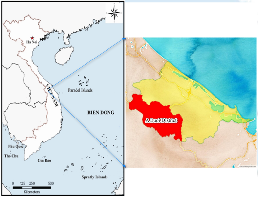
A Luoi is a mountainous district of Thua Thien Hue province, Vietnam, with rugged terrain, steep slopes, and many valleys. A Luoi district bears many risks of natural disasters such as storms, floods, droughts, and landslides yearly. This study applied the AHP (Analytical Hierarchy Process) model with the GIS tool on the input database of Sentinel-2B Image, DEM, and geographic background data to evaluate the influence of 5 factors: slope, elevation, aspect, land cover, and vegetation to generate a landslide hazard zoning map, scale 1:50,000. The results show that the sites with a high risk of landslides are concentrated mainly in the communes of Hong Kim, Hong Ha, Son Thuy, Hong Thuong, Phu Vinh, and Huong Nguyen. Thereby helping people avoid and minimize vulnerabilities caused by landslides.
Toàn văn bài báo
Trích dẫn
[2]. A. Hansen, C. A. M. Franks, P. A. Kirk, A. J. Brimicombe, and F. Tung (1995). Application of GIS to hazard assessment, with particular reference to landslides in Hong Kong. Geographical Information Systems in assessing natural hazards, Springer, 273-298.
[3]. A. M. Youssef, H. R. Pourghasemi, B. A. El-Haddad, and B. K. Dhahry (2016). Landslide susceptibility maps using different probabilistic and bivariate statistical models and comparison of their performance at Wadi Itwad Basin, Asir Region, Saudi Arabia. Bull. Eng. Geol. Environ, Vol. 75, Issue. 1, 63-87.
[4]. Ayalew, L., Yamagishi, H., Marui, H., Kanno, T., (2005). Landslides in Sado Island of Japan: Part II. GIS-based susceptibility mapping with comparisons of results from two methods and verifications. Eng. Geol, Vol. 81, 432-445.
[5]. Christos Chalkias et al., (2014). GIS-based landslide susceptibility mapping on the Peloponnese peninsula, Greece. Journal of Geosciences, Vol. 4, 176-190.
[6]. Cirianni, F., Fonte, F.,; Leonardi, G., Scopelliti, F., (2012). Analysis of lifelines transportation vulnerability. Procedia Soc. Behav. Sci, Vol. 53, 29-38.
[7]. Cirianni, F., Leonardi, G., Scopelliti, F., (2008). A methodology for assessing the seismic vulnerability of highway systems. AIP Conf. Proc, Vol. 1020, 864-871.
[8]. D. J. Varnes (1984). Landslide hazard zonation: A review of principles and practice. Commission on landslides of the IAEG. Nat. hazards, vol. 3, p. 61.
[9]. Doan Viet Long, Nguyen Chi Cong, Nguyen Quang Binh, Nguyen Tien Cuong (2020). Assessing the current situation and research solutions on landslides in Vietnam in the period 2010 - 2020. Journal of Irrigation Science and Technology, vol. 61, 119-128.
[10]. El Jazouli, A., Barakat, A., Khellouk, R., (2019). GIS-multicriteria evaluation using AHP for landslide susceptibility mapping in Oum Er Rbia high basin (Morocco). Geoenviron. Disasters, Vol. 6, p. 3.
[11]. F. Guzzetti, P. Reichenbach, M. Cardinali, M. Galli, and F. Ardizzone (2005). Probabilistic landslide hazard assessment at the basin scale. Geomorphology, vol. 72 issues. 1-4, 272-299.
[12]. F. Guzzetti, P., Reichenbach, M., Cardinali, M., Galli, and F., Ardizzone (2005). Probabilistic landslide hazard assessment at the basin scale. Geomorphology, vol. 72, issue. 1-4, 272- 299.
[13]. Information portal A Luoi district. https://aluoi.thuathienhue.gov.vn/?gd=21&cn=89&tc=1804.
[14]. H. R. Pourghasemi, Z. T. Yansari, P. Panagos, and B. Pradhan (2018). Analysis and evaluation of landslide susceptibility: a review of articles published during 2005 - 2016 (periods of 2005 - 2012 and 2013 - 2016). Arab. J. Geosci, vol. 11, issue. 9, p. 193.
[15]. M. Alvioli and R. L. Baum (2016). Parallelization of the TRIGRS model for rainfall-induced landslides using the message passing interface. Environ. Model. Softw, vol. 81, 122- 135.
[16]. P. Reichenbach, M. Rossi, B. D. Malamud, M. Mihir, and F. Guzzetti (2018). A review of statistically-based landslide susceptibility models. Earth-Science Rev, vol. 180, 60-91.
[17]. R. K. Dahal, S. Hasegawa, A. Nonomura, M. Yamanaka, T. Masuda, and K. Nishino (2008). GIS-based weights-of-evidence modeling of rainfall-induced landslides in small catchments for landslide susceptibility mapping. Environ. Geol, vol. 54. no. 2, 311-324.
[18]. T. Saaty (1990). Decision making for Leaders: The Analytic Hierarchy Process for Decisions in a Complex World. RWS Publications: Pittsburgh, PA, USA.
[19]. T. Saaty (1990). How to make a decision: The analytic hierarchy process. Eur. J. Oper. Res, vol. 48, 9-26.
[20]. Y. Huang and L. Zhao (2018). Review on landslide susceptibility mapping using support vector machines. Catena, vol. 165, 520-529.
[21]. Zaruba, Q., Mencl, V., (2014). Landslides and Their Control. Elsevier: New York, NY, USA.